Overview maps of the 2017 eclipse
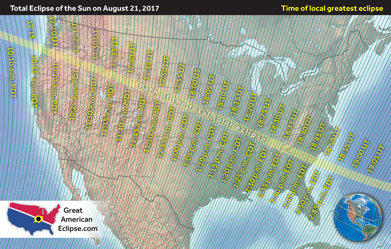
The total solar eclipse occurs only within the yellow path as shown in this map. Do whatever it takes to station yourself inside this path, preferably in the middle so that you can enjoy the maximum duration of totality. Furthermore, select your location on the basis of the short-term weather forecast and ensure that you can jump in a car and drive to another location if clouds threaten your location.
How to read these eclipse maps
On the map above, the yellow curves parallel to the path of the total solar eclipse mark the degree of maximum partial eclipse. 'Magnitude' refers to the maximum fraction of the Sun's disk occulted by the Moon. The green lines show the times of greatest eclipse as they sweep across the country. The time above the path of totality is given in Universal Time (formerly called Greenwich Mean Time) and time below is given in the local time zone. The orange curves inside the path of the total solar eclipse show the duration of the total solar eclipse. The longest durations of totality are in the middle part of the path.
The map below shows the same phenomena but with more detail.
The above image can be purchased in high-resolution at a size of 11" x 17" at www.greatamericaneclipse.com/all. The gallery of maps below show various eclipse circumstances. You can inspect eclipse magnitude, times of begin and end of the partial stage of the solar eclipse, times of local greatest eclipse, sun altitude in the sky at begin and end of the partial stage of the solar eclipse, and the sun altitude at local greatest eclipse.


